Client: National Parks and Wildlife Service
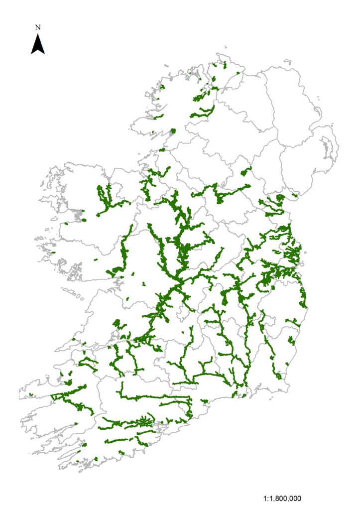
This project was divided into two stages. The first part of the project was primarily a GIS task that involved the collection and collation of habitat and management data on floodplain grasslands in Ireland. The research identified 1,308 km² of potential floodplain grassland habitat including 114 ha of the three target Annex I habitats Molinia meadows (6410), Hydrophilous tall-herb (6430), and Lowland hay meadows (6510). The second stage of the project involved the collection of botanical and management field-data from a subset of 27 sites from across the national floodplain grasslands dataset. Across all 27 sites, the most common habitat surveyed was semi-natural wet grassland (Fossitt code GS4), which represented 62% of the survey area. Overall, semi-natural grassland and marsh habitats covered 70% of the total survey area. The management practices within all areas where a grassland or associated habitat was present were recorded. Extensive cattle pasture was the most common management practice, recorded across 43% of the survey area.
Outputs from the project included a conservation assessment of the floodplain grasslands at each site and the impacts of factors such as agricultural intensification and flood protection for these grasslands. Other outputs included GIS maps and guidelines for the appropriate management of diverse semi-natural floodplain grasslands.
Citation: Martin, J.R., O’Neill, F.H. & Daly, O.H. (2023). Floodplain and Callows Grasslands in Ireland. Irish Wildlife Manuals, No. 144. National Parks and Wildlife Service, Department of Housing, Local Government and Heritage, Ireland.
In the accompanying figure, the areas shown in green are the potential floodplain grassland habitats in Ireland mapped by intersecting the PRIME2 dataset with a merged version of the OPW’s three datasets that map high (10%), medium (1%) and low (0.1%) probability of present day river flood extents (ROI only shown).